
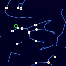
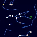
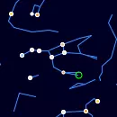
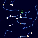
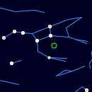
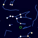
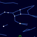
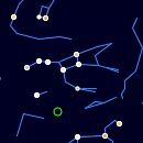
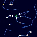
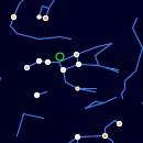
Ursa Major Constellation
Ursa Major (The Great Bear)
Ursa Major, or "The Great Bear," is one of the most famous and easily recognizable constellations in the night sky. It is a prominent northern constellation known for its distinctive asterism, the Big Dipper. This constellation has been important in navigation, mythology, and astronomy throughout human history.
Key Features
- Bright Stars: Ursa Major is home to several bright stars that form its distinctive shape:
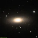
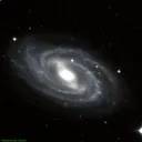
- Deep-Sky Objects: Ursa Major is rich in galaxies and other astronomical wonders:
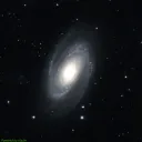
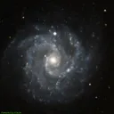
- Messier 81 (Bode’s Galaxy): A bright spiral galaxy located about 12 million light-years away.
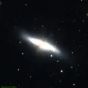
- Messier 82 (Cigar Galaxy): A starburst galaxy near M81.
- Messier 101 (Pinwheel Galaxy): A face-on spiral galaxy with intricate structure.
- NGC 3077: An irregular galaxy in the same region.
Mythological Background
In Greek mythology, Ursa Major is often associated with Callisto, a nymph who was transformed into a bear by Zeus to protect her from Hera's jealousy. Later, Callisto's son, Arcas, nearly hunted her, but Zeus intervened and placed them both in the sky as Ursa Major and Ursa Minor.
Many cultures have their own interpretations of this constellation. For example, in Native American mythology, it is seen as a bear being chased by three hunters. In Hindu mythology, it represents the seven sages or "Saptarishi."
Cultural Significance
Ursa Major has been crucial for navigation due to the Big Dipper asterism. The two stars Dubhe and Merak, known as the "Pointer Stars," lead directly to Polaris, the North Star. This made the constellation an essential tool for explorers and sailors in the Northern Hemisphere.
The constellation is also associated with the changing seasons. Its visibility shifts throughout the year, making it an important marker in various cultural calendars.
Ursa Major Rise and Set Timetable
| Time | Elevation | |
| Ursa Major is always above the horizon | ||
Moon Rise, 0.3% illuminated  | 04:03 | 1° |
| Ursa Major Transit | 15:00 | 75° |
| Sunset | 18:27 | 51° |
| Civil sunset | 18:58 | 47° |
| Moon Set | 19:11 | 45° |
| Astrosession begin | 19:36 | 41° |
| Ursa Major is always above the horizon | ||
| Astrosession end | 02:51 | 0° |
| Civil sunrise | 03:29 | 0° |
| Sunrise | 04:00 | 1° |
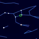
Track Ursa Major Position Throughout the Night
← Wed, 15 July 2026 →
| Time | |
| Altitude | |
| Azimuth |
Nebulae in the constellation Ursa Major
IC0921
Galaxy

IC0931
Galaxy
NGC2686
Galaxy Pair
NGC2687
Galaxy Pair

NGC2768
Galaxy
Bode's Galaxy (M81)
Galaxy
Cigar Galaxy (M82)
Galaxy
NGC3077
Galaxy
NGC3180
HII Ionized region
NGC3184
Galaxy
NGC3231
Open Cluster
NGC3406
Galaxy Pair
NGC3545
Galaxy Pair
NGC3550
Galaxy Pair
M108
Galaxy
Owl Nebula (M97)
Planetary Nebula
NGC3690
Galaxy Pair
NGC3991
Galaxy Pair
M109
Galaxy
NGC4054
Galaxy Triplet
NGC4199
Galaxy Pair
NGC5447
HII Ionized region

NGC5450
HII Ionized region

NGC5453
HII Ionized region

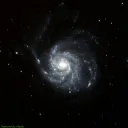
M101
Galaxy
NGC5458
HII Ionized region

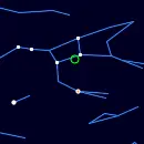
Annual motion of Ursa Major
| Date | Wed, 15 July 2026 |
| Twighlight start | 20:13 |
| Twighlight end | 02:04 |
| Twighlight duration | 6h 51m |
| Rise | Ursa Major is always up |
| Set | Ursa Major is always up |
| Elevation at transit | 75° |
| Transit time | 14:57 |
| Equatorial coordinates | RA: 11h 24m 36s", Dec: 52° 46' 12s |
| Magnitude | - |
| Constellation |
The graph is structured with the vertical axis showing the hours of the day, ranging from 12 AM to 12 AM the next day, while the horizontal axis spans each day of the year.
The reddish shaded area indicates the periods when the Ursa Major is above the horizon, visible to observers. The white line marks the times when the celestial object reaches its highest point in the sky each day, known as the transit. You can also view detailed visibility information in a dedicated table, including exact rise, transit, and set times for each date.
Acknowledgements
We gratefully acknowledge the International Astronomical Union (IAU) for defining and standardizing the official constellation boundaries, which provide a consistent framework for celestial mapping.
Special thanks to Sky & Telescope Magazine and contributors Roger Sinnott and Rick Fienberg for their collaboration in producing the charts and tables. The constellation patterns, drawn by Alan MacRobert, were influenced by the work of H. A. Rey and thoughtfully adjusted to align with earlier traditions.